Bestand:Map of Malta 2.png
Grootte van deze voorvertoning: 531 × 599 pixels. Andere resoluties: 213 × 240 pixels | 425 × 480 pixels | 987 × 1.114 pixels.
Oorspronkelijk bestand (987 × 1.114 pixels, bestandsgrootte: 1,34 MB, MIME-type: image/png)

|
This map has been uploaded by Electionworld from en.wikipedia.org to enable the |
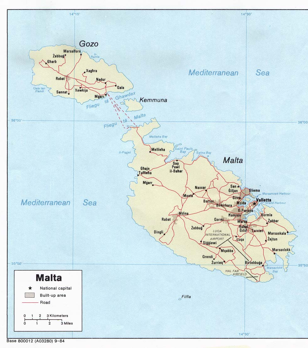
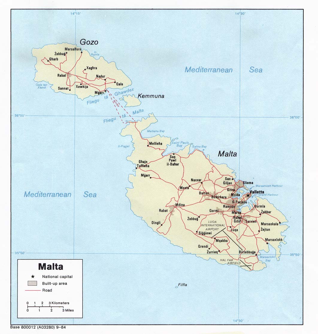
Political map of Malta. Created in 1984 by the Central Intelligence Agency.
Deze afbeelding bevindt zich in het publiek domein omdat het materiaal bevat dat oorspronkelijk afkomstig is van het CIA World Factbook.
|
 |
http://www.lib.utexas.edu/maps/europe.html
http://www.lib.utexas.edu/maps/europe/malta_pol84.jpg
Bestandsgeschiedenis
Klik op een datum/tijd om het bestand te zien zoals het destijds was.
| Datum/tijd | Miniatuur | Afmetingen | Gebruiker | Opmerking | |
|---|---|---|---|---|---|
| huidige versie | 27 dec 2006 20:40 | | 987 × 1.114 (1,34 MB) | wikimediacommons>Electionworld | {{ew|en|Neutrality}} Political map of Malta. Created in 1984 by the Central Intelligence Agency. {{PD-USGov-CIA-WF}} http://www.lib.utexas.edu/maps/europe.html http://www.lib.utexas.edu/maps/europe/malta_pol84.jpg |
Bestandsgebruik
Dit bestand wordt op de volgende pagina gebruikt:
Globaal bestandsgebruik
De volgende andere wiki's gebruiken dit bestand:
- Gebruikt op miraheze.org
