Bestand:Pre-roman iron age (map).PNG
Grootte van deze voorvertoning: 577 × 600 pixels. Andere resoluties: 231 × 240 pixels | 462 × 480 pixels | 657 × 683 pixels.
Oorspronkelijk bestand (657 × 683 pixels, bestandsgrootte: 38 kB, MIME-type: image/png)
Beschrijving
| Beschrijving |
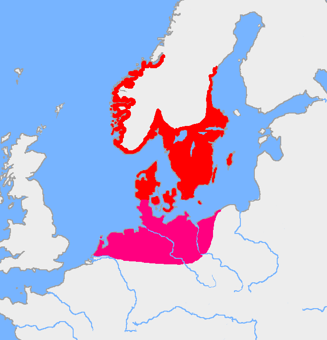
English: Map of the Nordic Iron Age and the Jastorf culture. |
||
| Datum | |||
| Bron | Image:Europe plain rivers.png and the Harper Atlas of World History (ed. Vidal-Naquet) in Swedish translation: Atlas över mänsklighetens historia. | ||
| Auteur | Copied from en:, uploaded by Wiglaf | ||
| Andere versies |
|

Licentie
| Dit werk vrijgegeven in het publieke domein door de auteur, Wiglaf. Dit is wereldwijd van toepassing. In sommige landen is dit wettelijk niet mogelijk; in die gevallen geldt: |
Bestandsgeschiedenis
Klik op een datum/tijd om het bestand te zien zoals het destijds was.
| Datum/tijd | Miniatuur | Afmetingen | Gebruiker | Opmerking | |
|---|---|---|---|---|---|
| huidige versie | 8 aug 2017 07:43 | | 657 × 683 (38 kB) | wikimediacommons>Velivieras | Updated the map concerning the Åland islands. Scandinavian influence to the island started in 11th century. |
Bestandsgebruik
Dit bestand wordt op de volgende pagina gebruikt:
Globaal bestandsgebruik
De volgende andere wiki's gebruiken dit bestand:
- Gebruikt op miraheze.org
.PNG)
.PNG)
.PNG)