Bestand:Public Schools Historical Atlas - Roman Empire 4th century.jpg
Grootte van deze voorvertoning: 766 × 599 pixels. Andere resoluties: 307 × 240 pixels | 614 × 480 pixels | 982 × 768 pixels | 1.280 × 1.001 pixels | 1.622 × 1.269 pixels.
Oorspronkelijk bestand (1.622 × 1.269 pixels, bestandsgrootte: 800 kB, MIME-type: image/jpeg)
Beschrijving
| Beschrijving |
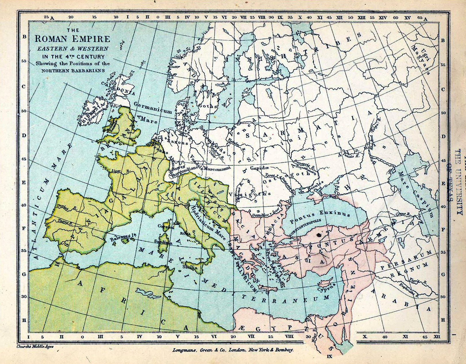
English: Map of Roman Empire in 4th century. |
| Datum | |
| Bron |
|
| Auteur |
|
Licentie
Dit mediabestand is in het publiek domein in de Verenigde Staten van Amerika. Dit geldt voor werken uit de VS waarvan de copyright is verlopen, meestal omdat de eerste publicatie ervan verscheen voor 1 januari 1929. Zie ook deze pagina voor verdere uitleg
|
 | |
 |
Let op! Dit bestand hoeft niet in het publiek domein te zijn buiten de VS (dit geldt voor Canada, China (excl. Hong Kong, Macao of Taiwan), Duitsland, Mexico en Zwitserland). De auteur en het jaar van publicatie zijn essentiële informatie en moeten zijn vastgesteld. Zie ook Wikipedia:Public domain en Wikipedia:Copyrights voor meer informatie.
|
Bestandsgeschiedenis
Klik op een datum/tijd om het bestand te zien zoals het destijds was.
| Datum/tijd | Miniatuur | Afmetingen | Gebruiker | Opmerking | |
|---|---|---|---|---|---|
| huidige versie | 18 jun 2009 19:58 | | 1.622 × 1.269 (800 kB) | wikimediacommons>Yarl | == {{int:filedesc}} == {{Information |Description={{en|Map of Roman Empire in 4th century.}} |Source= * ''The Public Schools Historical Atlas'' by Charles Colbeck. Longmans, Green; New York; London; Bombay. 1905. * [http://www.lib.utexas.edu/maps/historic |
Bestandsgebruik
Dit bestand wordt op de volgende pagina gebruikt:
